Promoting handcrafts from Nakai-Nam Theun National Park at the Folk Art Market Fair 2022 in Vientiane!
April 3, 2022Collection of water samples in Nakai-Nam Theun National Park to detect Endangered species of fish
June 1, 2022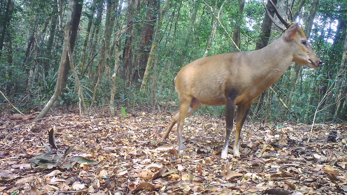
We are pleased to share our latest publication, the result of several years of collaborative work from field teams (Association Anoulak and Nakai-Nam Theun National Park) and technical teams (Association Anoulak and the Leibniz Institute for Zoo and Wildlife Research in Germany).
In this research paper, we investigate the ecological, environmental and anthropogenic variables in Nakai-Nam Theun National Park driving the distribution and population status of three sympatric muntjac species occurring in the national park: the Annamite dark muntjac species complex Muntiacus rooseveltorum/truongsonensis, the northern red muntjac M. vaginalis, and the large-antlered muntjac M. vuquangensis.
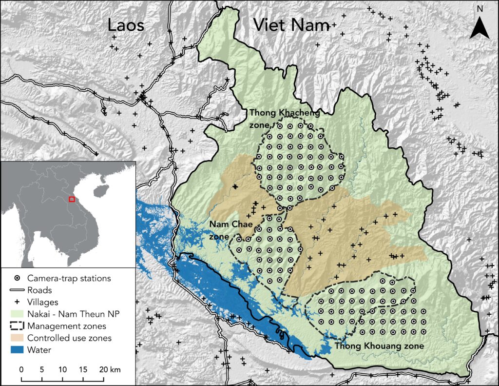
Study area map of Nakai- Nam Theun national Park, Laos. Camera trapping was conducted in three different management zones between February 2018 and May 2019
We conducted a landscape-scale systematic camera-trapping surveys (overall >20,000 camera-trap nights) in Nakai-Nam Theun National Park in 2018-2019. We analyzed camera-trap muntjac photograph records to evaluate the three species’ responses to environmental and anthropogenic variables, and to predict their distributions across the protected area.
Our research and analysis main observations and conclusions are:
- The three species of muntjac show varying responses to the variables, indicating complex drivers of occurrence
- Annamite dark muntjac was predominantly found at higher elevations, consistent with previous qualitative assessments that the species complex is more common in highland areas across its range
- Northern red muntjac occupancy peaked at approximately 1250 m asl., but declined at elevations above this, consistent with previous assessments that in Laos the northern red muntjac may be uncommon above 1500 m asl
- Large-antlered muntjac was predicted to range at higher elevations: contradicting previous speculations that the species predominantly occurs below 1000 m asl due to ecological habitat associations
- All three muntjac had higher occupancies in more inaccessible areas, as their populations are likely depressed by hunting pressure in less remote areas. From a conservation perspective, such a finding is more worrisome for large-antlered muntjac, given its Critically Endangered conservation status (the species is endemic to the Annamite Mountains: a restricted world range)
- The mean Percentage Area of Occupancy across the national park was higher for large-antlered muntjac, followed by Annamite dark muntjac and then northern red muntjac
- Large-antlered muntjac and northern red muntjac were distributed more widely across the national park, while Annamite dark muntjac was restricted to high elevation areas
- Given the high occupancies that we found for the Critically Endangered large-antlered muntjac, we argue that Nakai-Nam Theun National Park may be vital for the long-term survival of the species. Securing large-antlered muntjac, as well as other Annamite endemic species that are still present in Nakai-Nam Theun NP, is critical for the conservation of these species in the Annamite mountains.
- Assessing population changes over time is an integral part of adaptive management: Percentage of Area Occupied (PAO), occupancy estimates, and predictive maps all provide information that can be used to inform conservation decisions in Nakai- Nam Theun NP.
- Our occupancy estimates provide a robust conservation baseline for each muntjac and management zone, which can, in turn, be used to assess population trends and, ultimately, the effectiveness of conservation interventions.
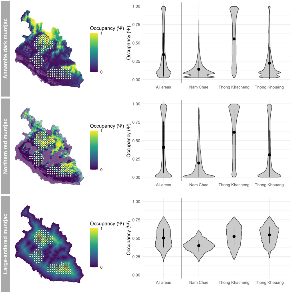
Predicted probability of occurrence for the three muntjac species across the Nakai-Nam Theun National Park. Transpar- ent colors indicate uncertain areas falling outside of the range of the covariates used. White dots with black outline represent camera-trap stations (left). Violin plots show occupancy probability per biodiversity priority zone and species (right). Mean and SD are shown inside each violin plot
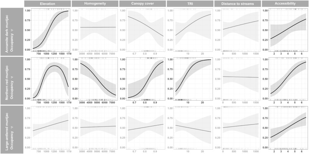
Response curves obtained from single covariate models. Light gray shades indicate 95% confidence intervals. Rugs correspond to detections (top) and non-detections (bottom). Accessibility is defined as the time needed to reach a certain area by foot from the nearest access point. Canopy cover indicates the % of canopy cover at each station. Distance to streams is the Euclidean distance between stations and the nearest streams. Elevation is the station’s elevation above sea level (from SRTM 30 m DEM). Homogeneity is a measure for habitat heterogeneity. Terrain ruggedness index is the mean difference in elevation between a DEM cell and its 8 surrounding cells
The Annamites ecoregion harbors exceptional levels of species richness and endemism, but intensive snaring has decimated populations of terrestrial mammals. Ungulates, such as muntjacs, are susceptible to snaring, and in need of effective conservation action.
- The large-antlered muntjac is listed as Critically Endangered on The IUCN Red List of Threatened Species and without immediate conservation efforts faces extinction in the near future.
- The northern red muntjac is listed as Least Concern, in part because there are stable populations across its widespread distribution, but populations in the Annamites are estimated to have declined in recent years.
- The Annamite dark muntjac species complex is currently listed as Data Deficient due to unresolved taxonomy and a lack of information on its status, though like all ungulates in the Annamites, its populations are probably declining
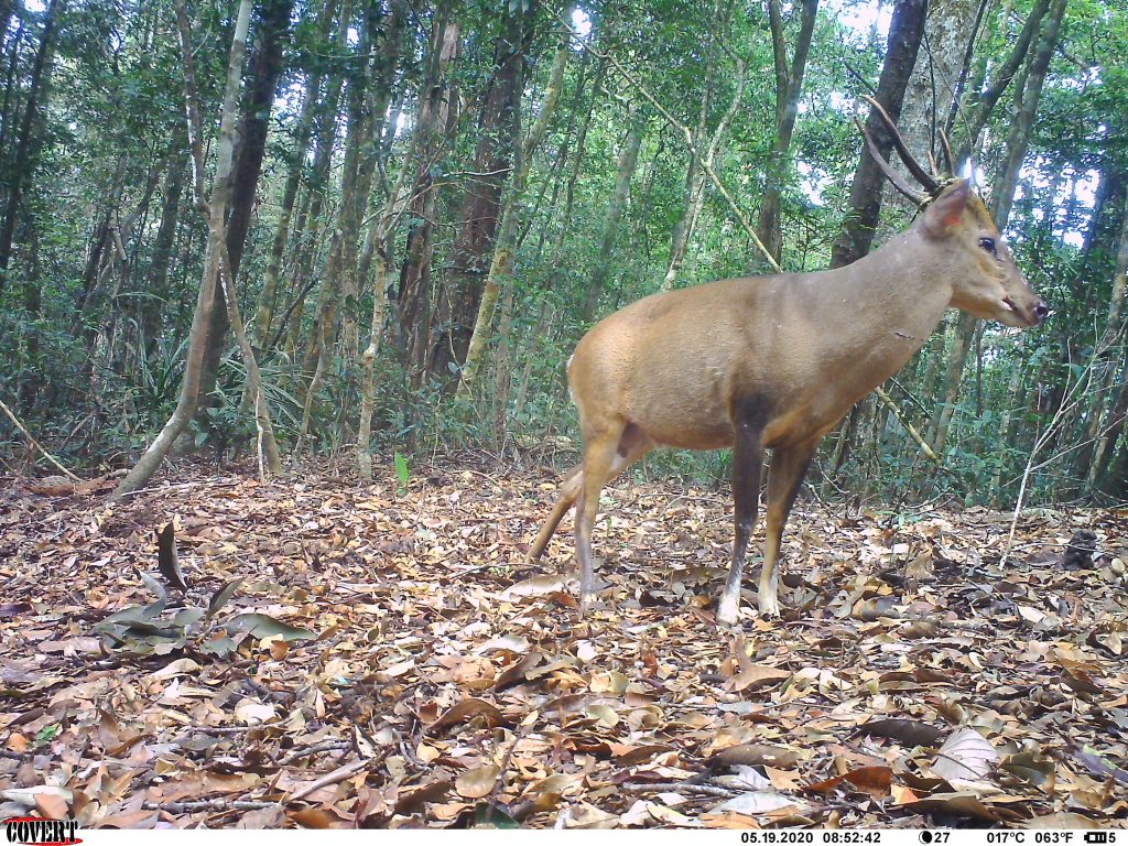
Large-antlered Muntjac – male. (c) Association Anoulak
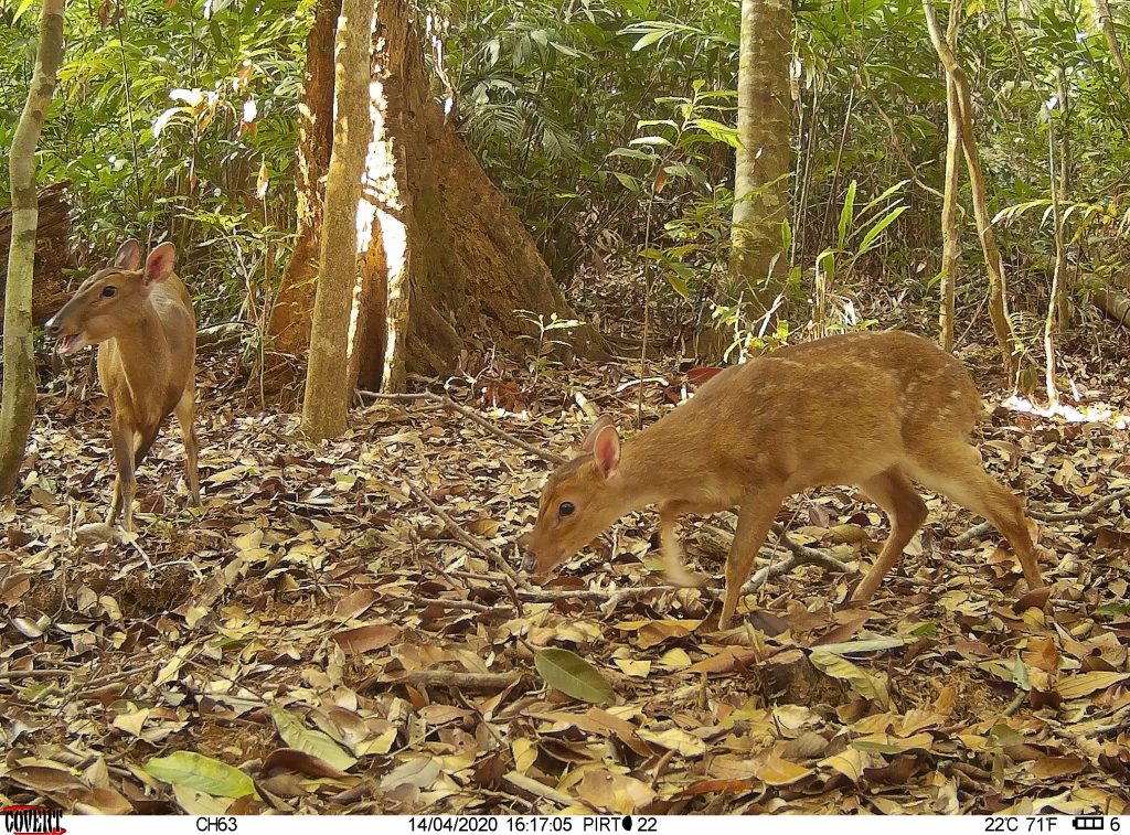
Large-antlered Muntjac – female with fawn. (c) Association Anoulak
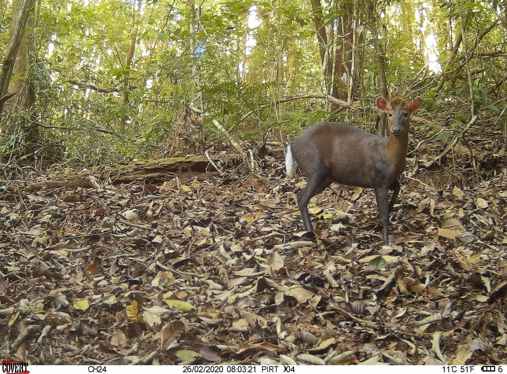
Annamite Sark Muntjac species complex.(c) Association Anoulak
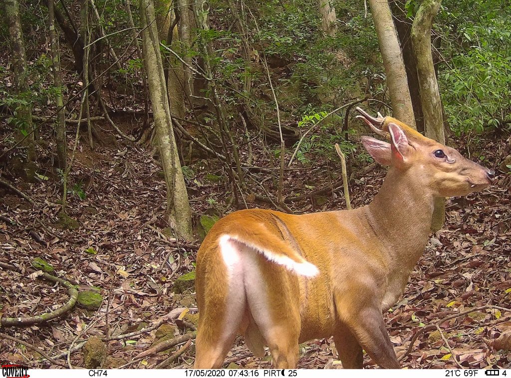
Northern Red Muntjac. (c) Association Anoulak
The publication can be accessed here:

